Populated since Antiquity, the town of Ile Rousse was prosperous for several centuries. It became a Roman trading post but its proximity to the sea made it subject to numerous invasions and its inhabitants left to live in villages in the hinterland such as Santa Reparata, Monticello, Corbara and Pigna. Ile Rousse as we know it today was founded by Pasquale Paoli in 1758. The main objective was to reduce Genoese activity in the towns of Calvi and Algajola. The first plans of the city are available at the Paoli Museum in Morosaglia. At sunset, the small island of Pietra is lit red thanks to its rocks. It had already been populated since Antiquity. The Romans also had a city for trade. On the peninsula you can see a Genoese tower as well as a lighthouse dating from 1857. The city center is symbolized by its Place Paoli, founder of the city, framed by palm trees. Every morning, the market is present in the covered market halls to buy local products: cold meats, honey, cheese… The train linking the two towns, Calvi and Ile Rousse, allows visitors to stop at the beaches without using the car.
Taking the N197, the road leads to Lozari, Belgodère marina with its bay with clear waters. When we go back inland, we arrive at Belgodère, a village perched at an altitude of 300m with its baroque Saint-Thomas church. The D63 takes its visitors to Speloncato, with its alleys and its fountain. A word of advice: a passage towards the Bocca di a Battaglia, a pass at an altitude of 1101 metres, is worth the detour to appreciate the heights in the region. It is also the starting point for paragliding and hang gliding enthusiasts. Coming down from the pass, we arrive in the Tartaigne valley, little known touristically, with several Genoese bridges (very rare in the region). Returning towards the village of Speloncato, we reach the village of Feliceto, with these two Genoese bridges: Fiscione and Reginu. A glassblowing factory is present in the village and is open to the public.
The road continues towards the villages of Muro, Avapessa, Cateri, then to Sant’ Antonio. In the film “L’Enquête Corse”, the hamlet is used as “Rossignioli”, a typical Corsican mountain village. The D151 continues towards Pigna, where many artists have settled. Walking through its streets, you can discover pottery workshops, musical instrument stores or even local products (honey, cold meats, jam, olive oil, etc.). In 1964, a cooperative association was created, Corsicada, whose objective is to revive the trades of yesteryear and to innovate in craftsmanship. The village is also home to an Italian-style church, built at the end of the 18th century.
2.5km further, we arrive at Corbara at the foot of Mount Sant’Angelo. Many religious buildings are open to visits such as the Notre-Dame des Sept Douleurs chapel, the Church of the Nativity of the Virgin or the Saint-Dominique convent. There are also chapels and oratories present throughout the village. As you stroll through the heart of its streets, you will find the village square and its fountain di u sbollaru, with its granite basin. At the top of the village, the Guy Savelli house museum will welcome you to discover the history of Balagne and Corsica.
Leaving the main road between Calvi and Ile Rousse, we arrive at the seaside village of Algajola. Within the seaside resort, we find the remains of the Genoese influence, with its fortress (unfortunately a private site) and its church dedicated to Saint George. Returning to the road towards Calvi, we pass through the village of Lumio which overlooks the bay of the capital of Balagne. This is the starting point for a hike towards the abandoned village of Oci. The last villager left in the late 1920s. Since then, the houses have deteriorated, despite a magnificent view from the heights of the village.
We arrive in Calvi via the T30. With its 5,000 inhabitants, Calvi is one of the main towns in Corsica and also one of the most touristy with the resort of Porto Vecchio. The bay, with its fine sand, extends over 6km and behind the beach, the pine trees provide shaded areas for holidaymakers. In the middle of the 13th century, the Romans founded the station, on their way to Marseille. The rocky peninsula became a fortified city, which benefited from numerous advantages, notably tax ones. Three bastions could be seen within the fortress: Malvetano to the southeast, Spinchone to the southwest and Teghiale to the northeast. Throughout its history, the town of Calvi has been loyal to the Kingdom of Genoa. Since 1967, paratroopers of the French Foreign Legion have been based in the city. The military police premises are in the heart of the Citadel, in the Sampiero barracks, and the 2nd parachute regiment is installed at Camp Rafalli. The two main streets of the city are the promenade at the port, where you can find many cafes and restaurants; and Rue Clémenceau, a pedestrian street with boutiques and shops. On the Saint-François peninsula, we find Place Christophe Colomb, the gateway to the heart of the Citadel. During your visit to the city, do not miss the church of Saint-Jean-Baptiste, which during the 17th century was elevated to the title of cathedral by Pope Gregory XIII, and also the chapel of Notre Dame de la Serra.
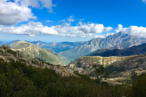
Calenzana is one of the largest villages in the Balagne hinterland. This is where the GR20 starts, a 15-stage hiking trail, which crosses all of Corsica. Within the village, there is a baroque church, Saint-Blaise, dating from the 17th century. Continuing the road on the D151 on the heights, we arrive at Zilia, the village where the sparkling water of the same name comes from, which can be found throughout the island. From Calvi, to reach Galeria, two routes are possible: by the coast, a winding road with panoramas lasting an hour and a half depending on traffic, or by the hinterland, cutting via Calvi airport , for about half an hour’s journey. The latter passes through the Bocca di Marsulinu, to then join the Marsolino valley in Fango.
Taking the coastal road, the route passes near the Revellata peninsula. The site is only accessible on foot to explore small coves and beaches. The next few kilometers of roads take us to views of the coast, passing by Crovani Bay, and also crossing the Fango River. In the Fango valley, there are many swimming places in the river, with pools of varying size depending on the site. Classified by UNESCO and Natura 2000, the Fango river will make you forget the sea for a few moments to dive into the heart of Corsican nature. Arriving at Galeria, we find ourselves in a gulf of the same name, and the mouth of the river. To the south of the bay, you can see a Genoese tower. After crossing Galeria, we pass the Palmarella and Croix passes, and the view extends to the Scandola nature reserve, and the village of Girolata.